
 Mobile mapping system based on Reigl LMS-420i. Israeli experience.
Mobile mapping system based on Reigl LMS-420i. Israeli experience.
By Valery Gutman, Dr. Evgeny Medvedev
Drakkar ltd.
Abstract
The on-ground laser scanning methods are widely recognized as one of the most accurate, reliable and productive in geodesy and in variety of its applications. On-ground laser scanning is the most inexpensive technology amidst the other kinds of laser scanning such as mobile mappers, airborne topographical and bathymetrical scanners. The relatively low cost of on-ground laser scanner system can be easily explained by the fact they do not include Inertial Measurement Unit which would make it possible to carry out survey in mobile, i.e. “fast” mode. So, the on-ground laser scanners main advantage (low cost) turns to be its main drawback (poor productivity). That is why all investigations pointed at increasing on-ground laser scanning productivity by software and methodological measures are rather welcome nowadays.
In this article such methods proposed by Israeli company Drakkar ltd. have been discussed. The method is based on fusing laser scanning, GPS and theodolite survey and allows increasing survey productivity up to 5-10 times against the traditional static method. The special software for realization of the proposed method is also described, as well as a number of examples of its practical application in Israel and globally.
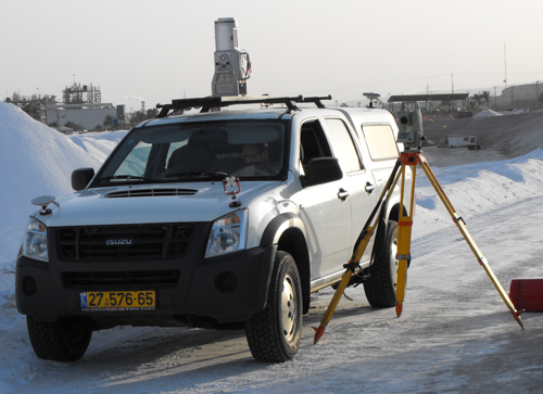
The full assembly.
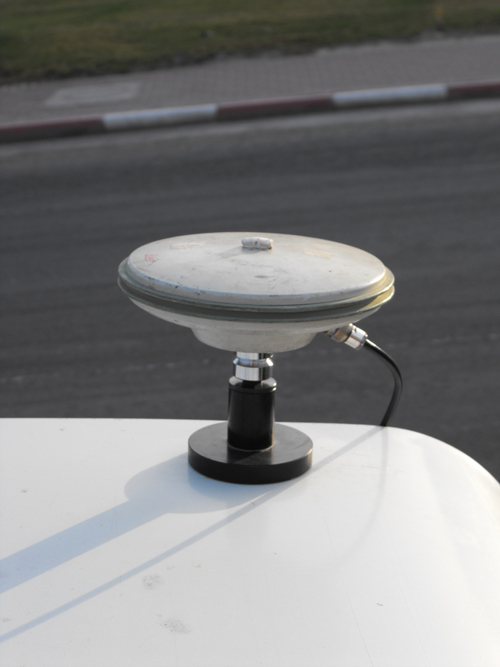
GPS antenna on the roof
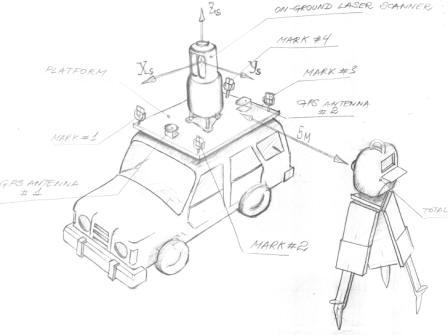
The principal scheme of the platform
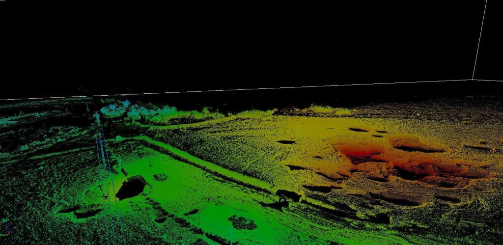
Dead sea landscape made by proposed method